Traffic and transport matters
Providing better traffic and transport solutions in Manly for people in cars, on public transport, bikes and also for pedestrians is a key aim of Manly2015.
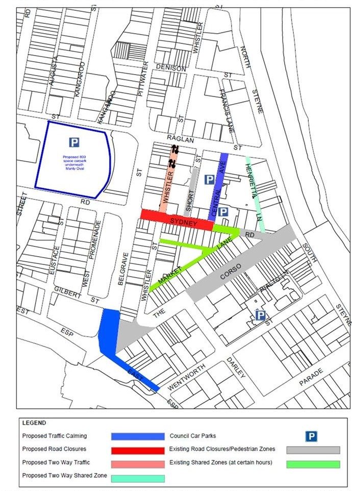
The 800 place car park beneath Manly Oval features as part of Manly2015 and its location is designed to capture the majority of vehicular traffic with a Manly CBD destination. The new facility will have an entrance and exit from Sydney Road.
New cycling lanes are proposed for Raglan Street, as well as opportunities to incorporate additional bike parking stations within the Manly CBD.
Sydney Road, will be pedestrianised (between The Corso and Whistler Street), allowing excellent pedestrian movement and more open public space for all to enjoy. Increased foot traffic will increase opportunities for the retail and service sectors and benefit local traders.
As a masterplan Manly2015 will continue to provide the impetus for Council going forward to improve public transport arrangements servicing Manly through continued discussions with the relevant State Government agencies. Ferry and Bus passengers will be able to utilise the new Manly Oval and its additional capacity (over the Whistler Street Car Park it replaces) as a park n ride facility.
Outcomes of Consultation 2011
As a result of the consultation conducted in 2011 for Manly2015 the proposed entrance / exit point from Raglan street into the Manly Oval car park and the proposed shared zones for Whistler Street and North Steyne Manly are not proceeding as part of the Masterplan.
Manly Oval Car Park
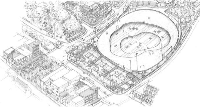
A new state of the art car park facility is planned to be developed beneath Manly Oval capturing visitor traffic before it gets into local CBD streets.
Traffic Plan
The final proposed traffic plan relating to Manly 2015 which was developed taking into consideration feedback given to Council during the Public Exhibition Period.